Thursday, November 1, 2012

WILSON TRAIL SECTION 9

PAT SIN LENG RIDGE - is a mountain range in the northeast New Territories of Hong Kong. Located within the Pat Sin Leng Country Park. The name Pat Sin Leng literally means "Ridge of the Eight Immortals", who are famous xian ("Immortals; Transcendent; Fairies") in Chinese Mythology, and symbolizes the eight peaks along the Pat Sin Leng mountain range, each are named after the eight immortals. 

Mountain Peaks:
  • Shun Yeung Fung (591m), a.k.a : Lu Dongbin
  • Chung Li Fung (543m), a.k.a : Zhongli Quan
  • Kuai Li Fung (530m), a.k.a : Iron-Crutch Li
  • Kao Lao Fung (530m), a.k.a : Elder Zhang Guo
  • Hsien Ku Fung (514m), a.k.a : Immortal Woman He
  • Sheung Tsz Fung (510m), a.k.a : Han Xiang
  • Tsao Kau Fung (510m), a.k.a : Royal Uncle Cao
  • Choi Wo Fung (510m), a.k.a : Lan Caihe

TRANSPO:
  • Take the KCR Trail to Fanling Station and leave by Exit A.
  • Take the Mini Bus 52 heading towards Hok Tau Wai Village near Hok Tau Reservoir.
TRAIL INFO:
  • Difficulty: 4/5
  • Distance: 10.6 Km
  • Duration: 4.5 Hours
  • Terrain: 70% Natural Trail, 10% Tarmac & 20% Modified Trail

LOGISTICS:
  • 10L - 25L Packs
  • 2L - 3L Water
  • Light weight clothing material (Convertible Type)
  • 1 Extra Shirt
  • Hiking Pole (Optional)
  • Sturdy Hiking Shoes/Boots
  • Food/Snack/Power Bars (Optional)
LET'S GO!


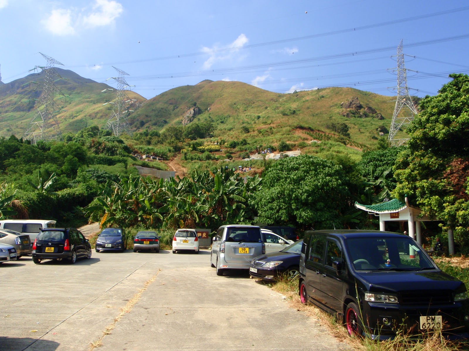
STARTING POINT
Originally, the starting area of Pat Sin Leng Ridges (Wilson Trail Stage 9) is at the top of the Cloudy Hill Section 8 of the Wilson Trail, but this is an alternative route in case u wish you to venture this on a separate occasion. This located close to the Hok Tau Wai Village. 

Immediately after passing the Entry Gate, you will see the
Hok Tau Campsite adjacent to the right side of the road.

This is the Hok Tau Reservoir Bridge that will take you to the Pat Sin Leng Ridges. be sure to locate the "Wilson Trail" post allocated along side of the road after passing this bridge.

Enter the Country Park Gateway and it will lead you toward the exact trail of Pat Si Leng Ridge.

The first of many mountain range that you will encounter and overcome along the Ridges.

PING FUNG SHAN
An accelerating first mountain range to endure, but after reaching that vividly color tree (a shady area where you can have a little bit of rest) all the rest will be side winding along the mountain. Unless your feeling kind of pumped up & hike the 2 humps.

PING FUNG SHAN
Minutes after passing the two mountain range, a more open trail will soon immerse 
and if a hiker is lucky enough to hike on a clear day, the city below and all the mountain ranges is a treat. 

SUMMIT
Trigonometric Post of Ping Fung Shan  

After reaching the summit of Ping Fung Shan, the adventure will soon gets better and better because you are now going to meet the Pat Sin Leng Ridge (The 8 Immortals).

Here's the first among the eight immortal board marker that you will meet on top of Pat Sin Leng Ridge...

...after having a great deal of hiking along the Ridge, now comes- the final Immortal board marker.
(As you can see the path on the right side will lead you downhill)

SUMMIT
Final look at the Pat Sin Leng Ridges before heading downhill on he right. This might be easy because going down the hill has plenty of stairs but a natural trail is still available if one is not a fan of stairs. When the "T" road section is reached, there are choices if one must continue to finish Wilson Trail 9 (Left-side) and end the adventure at Bride's Pool Road (Take 75R to get back into the city), the other route (Right-side) will lead a hiker to TAI MEI TOK. Hiker/s will end at the Country Park Office. Walk toward Tai Mei Tuk Village and a buses are available to return to the city (75K or a Green Mini Bus heading towards Tai Po Market).


Friendly Reminder
Enjoy Your Country Park, Enjoy Hiking and Leave No Trace!

DOG TEETH (WEST)

Dog Teeth Range (Kau Nga Ling), is one of the most famous hiking trail for extreme hikers. This is preferably not for novice but a great deal of challenge for intermediate hiker/s. It's perilous but intriguing scenery earns the fame for many thrill seekers. It is located at the south side of Lantau Peak (#2 Highest Peak in Hong Kong). At the moment, there are no tall object standing at the the south side, so you can enjoy the fascinating panorama of Southern Lantau while doing hiking. As the name suggests, The Dog Teeth Range looks like dog's teeth in terms of shape and sharpness.

Advisory:
If your attempting this trail, you must take a great deal on safety. Good Luck!

TRANSPO:

  • From: Tung Chung Bus Terminal take the NLB no. 11 or 23.
  • From: Mui Wo Pier Take the NLB no. 1 or 2.


TRAIL INFO:

  • Difficulty: 4/5
  • Distance: 6 Km
  • Duration: 3 hours
  • Terrain: 90% Natural Trail & 10% Modified Trail


LOGISTICS:

  • 18L - 30L Pack
  • 2L-3L of Water (Depending on the weather condition)
  • Hiking Pole (Optional)
  • Light-weight clothing materials
  • Sturdy Hiking Shoes/Boots
  • 1 Extra Shirt
  • Food/Snack/Fruit/Power Bars (Optional)

LET'S GO!


STARTING POINT
This can be accessed by walking back from the bus station at Shek Pik Reservoir after 15-20 ride from Mui Wo or Tung Chung. 

Cross this Bridge which is adjacent to the Country Park Warden Office and
you will find the 60 degrees elevation of stairs. Proceed toward's the left of it when you reached the top of the part of the stairs (try not to turn right otherwise you will be doing the "MIDDLE DOG TEETH" Trail. 

Taken from afar but this is just to let you prepare on what's your Entry Point looks like.

This is your Entry Point to the (West) Dog Teeth Range. 

This is the section of the trail that you must concentrate on because this is perilous.
(Be very careful around here!)

KAU NGA LING
A knife edge hiking section of Dog Teeth

(Proceed with extreme caution)

SHEK PIK RESERVOIR
This is an island water storage facility located at Lantau South Country Park. With a capacity of 738.000,000 cubic feet, it was once the largest reservoir in Hong Kong but now it just the third largest Reservoir after High Island & Plover Cove.

END POINT
This end point is the gateway of the Lantau Peak Trail which is adjacent to the
Phoenix Statue and the Wisdom Path (Wisdom Path traces a series of 38 wooden steles containing verses from the centuries-old Heart Sutra; one of the world's best-known prayers revered by Confucians, Buddhists and Taoists alike).


Friendly Reminder
Enjoy Your Country Park, Enjoy Hiking and Leave No Trace!


CASTLE PEAK

CASTLE PEAK (Pui To Shan) is a 583 meters above sea level high in western New Territories of Hong Kong. In contrast to its Chinese name, which means green hill, Castle Peak is notorious for its severe loss of vegetation and weathering of its Granite surface. The area to the west of the hill was also named Castle Peak. It is an industrial area with several power plants owned by CLP (Castle Peak Power Station & Black Point Power Station). It is also the old name of Tuen Mun during the early British rule before starting the development of Tuen Mun New Town. In the early proposal of the development, the new town was called Castle Peak New Town. Most of the area of the hill is under firing range used by military and police forces in Hong Kong. Warnings are issued to the public before exercises was carried out and therefore among the few hills in Hong Kong which are not part of a Country Park.

TRANSPO:
- Take KMB BUS 961 (The most direct transportation to get the starting point at HO TIN TSUEN. The bus can be taken at Admiralty Station and get off from the bus when it reaches its Terminal in Tuen Mun.

TRAIL INFO:
Difficulty: 4/5
Distance: 8 km
Duration: 4 Hours
Terrain: 90% Natural Heath & 10% Trail Modification

LOGISTICS:
-10L-30L Pack
-3L of  H2O
-Ultra Light Weight Clothing Materials
-Hiking Pole (Optional)
-Power Bars/Food/Snack

LET'S GO!

This is the starting point near the Bus Station 961 (Ho Tin Tsuen).

A FORK
Take the right side here and immediately you will be walking on a slightly steep road.

PARKING LOT
Proceed ahead and you will soon find the Chinese Cemetery, just simply walk up the stairs and when you reach the last tomb...turn right, then immediately hike uphill starts there!

This is officially the beginning of your adventure and from here you will start to do a lot of uphill hiking.

Prepare yourself to walk through the sharp grasses and bushes. It may seem difficult but the walking trail is available though it's a bit covered by grasses.

Here you will no longer walk through any grasses and bushes because a barren landscape will immerse immediately.  

This is one of the three (1/3) Trigonometric Post (Summit Marker) close to the Castle Peak Summit. 

CASTLE PEAK
This is the summit of Castle Peak and it's populated with antennae.

CASTLE PEAK SUMMIT (585masl)

This is the section where you can end your adventure...just follow the  predictable pathway on the trail.

Exciting yet dangerous path...it will be a very serious injury if you miscalculate path around it.  Be careful around here!

After a few seconds, you will be under the trees like this one and  you must try to follow some friendly signs (Red, Yellow, White...etc. ribbon) hanging on trees.

Underneath the Electric Tower is a passage to your exit point.

To return to the city... Take Bus 52 Heading Tuen Mun MTR Station.


Friendly Reminder
Enjoy Your Country Park, Enjoy Hiking and Leave No Trace!

Monday, October 22, 2012

MOUNT DAVIS

Mount Davis (269 meters above sea level) is a hill in the westernmost of Kennedy Town, Hong Kong Island, Hong Kong. It is named after John Francis Davis, who was the second Governor of Hong Kong, from 1844 to 1848.

TRANSPO
- Take the HK island Bus 5 to Felix Villa (Starting Point). 
- Take the bus 5X to Kennedy Town and walk about 15 minutes uphill to the starting point.

TRAIL INFO
- Difficulty: 1/5
- Duration: 1.5 Hours
- Terrain: 95% Concrete & 5% Natural Trail

LET'S GO!


STARTING POINT
The starting point of the trail is located exactly at the bus stop of
Bus 5  (Felix Villa) at the left side of the fork.

The trail is uphill and 95% concrete and 5% natural terrain.

Another fork? Well, Simply take the left side...

An age old abandon house like this one is what your going to witness in Mount Davis Path. It's used to be a military station during the WWII.

Walk a little more uphill and you will see this stairs and it will save your time from the winding road of Mount Davis Path. Take this route and you will get to the Jockey Club Youth Hostel in no time.

A refreshing uphill sheltered by trees.

The Jockey Club Youth Hostel 

Modern Structure next to a War Relics
(You can see this at the left side of the Jockey Club Youth Hostel)

BARBECUE AREA
This is made for the weekend goers and war-game players. If you wish to be away from the bustling city and spend some time with friend or family...this is a place to be!

PAVILION
A resting place for the Hikers, Walkers and the War-game players
(Beware of this place if some people are playing war-games)

RADIO ANTENNA
(This also serves as a battle field for the weekend war-game players, hikers and walkers) 

This is an old soldier barracks during the WWII now it's a national treasure but turns out to be a best location for weekend war-game players. 

MOUNT DAVIS SUMMIT
(Stands 269 meters above sea level)
From here you can see the HIGH WEST and VICTORIA PEAK on a clear day.

When your done browsing about at the summit of Mount Davis, simply walk back down to where you  climb up and locate this emergency calling booth next to an old school.

Just a bit down the curve you will see this banana trees.

On your downhill, you will be pampered by the shades of this trees until the trail ends. 

END ZONE
This is the end point of the trail and just down below is Victoria Road. Turn to the left and you can take Bus 5 again to get yourself back into the city or walk to the right and and locate the Kennedy Town Bus Terminal
(Around 5 mins walk).

This is the look of the end zone on the opposite side of the road.
This can be your starting point as well if you wish.


Friendly Reminder
Enjoy Your Country Park, Enjoy Hiking and Leave No Trace!