Showing posts with label HONG KONG TRAIL. Show all posts

Friday, August 16, 2013

HONG KONG TRAIL SECTION 4

HOW TO GET THERE:
The easiest and the fastest way is to take NWFB No.15 starting at the Exchange Square Bus Terminus heading towards the PEAK and get off at Wan Chai Gap by the end of Stubbs Road. Then take the Aberdeen Reservoir Road downhill for a short distance to begin Section 4.

TRAIL INFO: 
  • Difficulty: 2/5 (Easy Hike)
  • Distance: 7.5 Km
  • Duration: 2.0 Hour
  • Terrain: 50% / 50% of Natural trail and well maintained trail with a combination of concrete stairs, water catchment and uphill road. 
  • Scenery: There's perfect greenery on this trail and when you get to an opening, you will have glimpses of Aberdeen Reservoir and Ocean Park (Hong Kong's Amusement/Themed Park).
  • GPR Coverage: Excellent
  • Phone Coverage: Great
LOGISTICS:
  • Packs: 4L - 8L 
  • Liquid Supplements: 500 ml  > 800 ml
  • Food Supplement: Power Bar or Fruit
  • Clothing: (Summer) Shorts & Shirt (Winter) + Wind Breaker and Convertible Pants
  • Extras: (Some are optional) Shirt, Hat, Sunglasses and Mosquito Repellent and Sun Screen.
LET'S GO!


A friendly sign post next to the Information Board. You will see plenty of this sign post in the trail to ensure your safety on this Trail.


ENTRY POINT
Alright, after spending a few second at the information board and knowing your trail path, here is the main Entrance to Section 4. 


Like I mentioned, the trail is carefully marked with this kind of post so please don't get confused on your route. 


As you get deeper into the trail...you will feel the comfort of shade and shelter from the trees and the coolness of the breeze passing between the and through the trail.


Well this section is very refreshing! This photo is actually taken on top of the bridge but don't hesitate to go in and re-hydrate yourself during summer hike. A pretty good place to have your photo taken while the other person is on the opposite side (on the bridge) but be careful on the slippery rocks. 


OCEAN PARK
Located at Aberdeen but a pretty good view along the trail.


After enjoying a moment on the open section of the trail, now it's time to get inside the wilderness again. Another dome type shelter from the trees will continue to give shelter along the trail.


It's very quiet around here knowing Hong Kong is a small City, but and all you can hear is just the sound of water cascading, birds singing and the rejuvenating sounds of the forest in the modern wilderness of Hong Kong. "Pretty impressive!" - I might say.


On a clear day, if you get lucky...you will have a chance to see the Aberdeen Reservoir and its neighborhood.


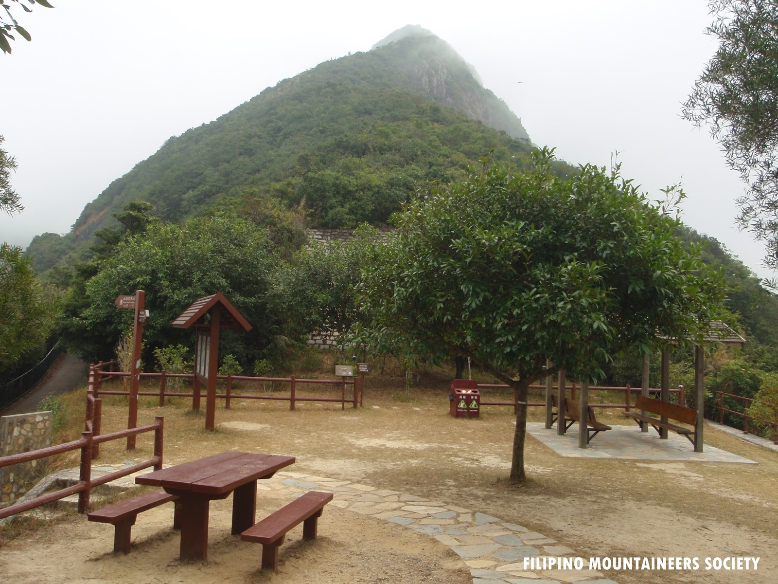
MOUNT CAMERON
After hiking through the natural trail, you will get to meet another concrete road with a wooden pavilion nearby. The Road is called "Black Link's" and at the opposite side of the road, you will see a sign post again that will lead you towards you exit point. The arrow pointing to the left will lead you back to your starting point at Wan Chai Gap Road and the one on the right will lead you to Wong Nei Chung Gap Road. I suggest you to take the route to the right to continue with the original trail!


MOUNT NICHOLSON
As you end the hike you will be walking along side with Mt. Nicholson and it is really very entertaining on this section because you will have plenty of opening to see the Repulse Bay Beach and Golf Course, Twin Peak, Violet Hill and Parkview ...these are some of the best part to expect on your way out to finish the Hike.

Even though this trail is very easy, it is rather enjoyable because of its scenic views! I usually run when I take this section and it's really a perfect place for it but you need to be careful because the senior citizens are doing their early morning walk around here as well.


Friendly Reminder
Enjoy The Wilderness & Leave NO Trace

HONG KONG TRAIL SECTION 3

HOW TO GET THERE:
Take public transport to Aberdeen Reservoir Road. Walk up Peel Rise by Pui Tak Canossian College for about 30 minutes to the starting point of Hong Kong Trail Section 3.
Transport routes available are:

City Bus:
No. 7 - running between Central Ferry Piers and Shek Pai Wan in Aberdeen
No. 76 - running between Shek Pai Wan in Aberdeen and Causeway Bay (Moreton Terrace)

NWFB:
No. 95 - running betwee Ap Lei Chau and Shek Pai Wan in Aberdeen

Mini Bus:
No. 52 - running between Shek Pai Wan in Aberden and Chung Hom Kok in Stanley (Ma Hang)

For your return journey, walk down Aberdeen Reservoir Road for about 15 minutes to Wan Chai Gap for public transport:

NWFB:
No. 15 - running between Central (Exchange Square) and the Peak
No. 15B - running between Tin Hau MTR Station and the Peak (Sundays and Public Holiday only)

TRAIL INFO:
  • Difficulty: 2/5
  • Distance: 6.5 Km
  • Duration: 2.5 Hrs.
  • Terrain: 20% Concrete and 80% Natural Trail
  • GPS Coverage: Good
  • Phone Coverage: Great
  • Route: Peel Rise > Wan Chai Gap
LOGISTIC:
  • Pack: 8L - 10L 
  • Liquid Supplement: 500ml > 1000ml
  • Clothing: Shorts & Shirt (Summer), Leggings & Wind Breaker (Winter)
  • Shoes: Regular rubber shoes works (but proper Hiking Shoes is better)
  • Food Supplement: Fruit or Snack (Optional)
  • Extras: Hiking Pole (Optional), Extra shirt, Hat, Mosquito Repellent & Sunglasses
LET'S GO!


STARTING POINT
(Roughly about 1/4hrs from Aberdeen Reservoir & 30 minutes from Chi Fu Estate)


Hong Kong Trail Section 3: Information Board


Another friendly trail sign; the trail is fully covered with signs to ensure your safe journey inside the trail.


Section 3 is perfectly shaded by trees so walking in this trail is very comfortable and cool and this is an awesome hiking ground for beginners, friends and family. 


Surprisingly beautiful. This stream comes to life during wet season in Hong Kong, the flow of water is very cool and refreshing.


When you reach this bridge you need to turn and proceed to the right side and try not to take the stairs.


DECISION  POINT
This is where you need to make a decision whether if you will turn right and end at Aberdeen Reservoir or turn left to continue with Hong Kong Trail Section 3 and end at Wan Chai Gap. Both will take at least 30 minutes between either point. I highly suggest that you proceed with the rest of the Hong Kong Trail Section 3 and end at Wan Chai Gap because in this manner you will only need to catch NWFB No.15 or 15B to return to the city.


END POINT
Finally the trail is done! But because Hong Kong Trail Section 3 is too easy for some hikers, many will quickly jump in and continue Section 4. The starting area is immediately located near the end point of Section 3. If you decided to finish the hike though, simply walk uphill and pass the barrier gate and turn left heading towards the main road (Wan Chai Gap) and take NWFB 15 heading Central Exchange Square passing through Ruttongee Hospital, Hopewell Centre, Pacific Place, Admiralty and finally Central.


Friendly Reminder
Enjoy The Wilderness & Leave No Trace

Friday, July 19, 2013

HONG KONG TRAIL SECTION 8

Welcome to the last and final stage of Hong Kong Trail! This is going to Easy and Fun!

HOW TO GET THERE:
  • Take the MTR and get to SHAU KEI WAN MTR Station
  • Take Exit A1 and immediately you will see the bus station on the left hand side.
  • Locate and board in to Bus 9 heading towards Shek O. 
  • Green Mini Bus is also available at MTR Exit A3 (immediately turn left on the exit and the mini busese will be there).
  • Final option is Taxi (...to expensive though)
TRAIL INFO:
  • Difficulty: 3/5 (Strenuous Hiking)
  • Distance: Roughly 8.5 km
  • Duration: 2.75hrs - 3hrs
  • Terrain 1: 40% Natural, 40% Modified steps and 20% Tarmac (Original Trail)
  • Terrain 2: 60% Natural, 30% Modified Steps and 10% Tarmac (Mt. Collinson Route)
LOGISTICS:
  • 8L-11L Pack
  • 1L Water/Energy Drink
  • Hiking Pole (Optional)
  • Good Hiking Boots
  • Regular Shorts and Shirt (Original Trail)
  • Long Sleeves and Convertible Pants (Mt. Collinson Route)
  • Personal Emergency Kit
LET'S GO!


STARTING POINT
Be alert on this bus stop because it comes after the bus curves around the road and if you miss it, u will walk back a bit longer...better let the bus driver know where your getting off.

This is what the starting point looks like


There will be a few stairs like this within the trail..I guess U can always have an option of walking along the side the the staircase just to hike a little more natural.

This beautiful panorama will appear quickly as soon as u get to the trail opening and you can actually see the Stanley Town is on the upper left.

Take the stairs uphill again. The trail is clearly mark and you should always peel your eyes on those signs because all of them indicates your grid location.

Immediately after 5mins this will amaze you... "Welcome to SHEK O!"

Just a little hike and this Luscious and Luxurious Mountain Range appears. Enjoy the natural trail from here until you reach the summit of Shek O.
 HIGH LIGHTS OF THE TRAIL


Looking back at the trail were you've been and the Hill of D'Aguilar is nicely blending with the rest of Dragon's Back Trail.

SHEK O SUMMIT


....and the trail goes on!


The Original trail continues to the left and all you have is a clear path with sign post and flat trail. The other option here is the passage behind that straight up post with Hikers logo; it'll take you in to the most entertaining part of  Hiking, Bushwacking and negotiating in a real jungle-like trail! But then again... the choice is up to you if you wish to continue with the original trail or the exciting option of Mt. Collinson Trail (you will get to see another summit marker up there). 

If you continue with the original trail this is it!
At the bottom of the stair, turn left and from here it will be flat trekking for about 23mins.

...this FLAT!

A little bit of trail entertainment specially during wet season, all the streams are strongly flowing cool water....you can scoop a few to refresh yourself.

PIT-STOP
There's a blue colored toilet on the left side and when your done here, please proceed to in a direction heading Big Wave Beach. By looking at this photo, you will need to turn right and walk on concrete road for the next 15mins or so.


...after walking for 15mins, the road ends and you must turn left and then right immediately (you may need to walk in a direct towards the Pavilion).


You need to pass the Pavilion by walking along the catchment and you'll soon see this...the sign post will lead you to Big Wave Beach, just simply walk down the stairs and the rest of the trail will take another 20mins  before reaching the final sign post "100".

Here is the final post "100" and this means "Hong Kong Trail" is done. There are no welcoming committee, no red carpet, no band playing your favorite tune and no certificate of accomplishment from the town Mayor. This is simply letting you know that you finished all  Hong Kong Trail and you have proven to yourself that you can accomplish something that you will cherish for ever. 

Perfect ..."100"

"SHEK O BEACH"
As for your own personal reward, you can take a dip at Big Wave Beach or Shek O Beach and treat yourself with anything you like at the restaurants along the beach.

"CHEERS and CONGRATULATIONS!"
Welcome To The Next Level!


Friendly Reminder
Enjoy Your Country Park, Enjoy Hiking and Leave No Trace!

HONG KONG TRAIL SECTION 7

HOW TO GET THERE:
  • Take the MTR to Sai Wan Ho and board on Bus 14.
  • Alight immediately before the bus crosses the giant main dam, opposite the Aquamarine-coloured waterworks building. 
  • Walk back and trace the bus route for about 12mins until you reach the Map-Board.
TRAIL INFO:
  • Difficulty: 2/5
  • Duration: 2.5 hours
  • Distance: 7.5 km.
  • Terrain: 80% Concrete and 20% Natural Trail but maintained.
LOGISTICS:
  • 10L-15L Pack
  • 1L Water
  • 1L Energy Drink
  • Snack/Fruit/Energy Bar (Anything will do)
  • Sunblock (Summer as it gets so hot out here because it's so exposed)
  • Mosquito Repellent (Optional)
  • Good and Comfortable Hiking Shoes (it's a long walk out here)
  • Clothing (wear according to the weather condition)

LET'S GO!

MAP BOARD
This is the starting point of the trail and when u get here you might wonder...Where is the trail? You need to cross the road carefully and try to get to the opposite side of the road and head down the staircase between the main road railings. The rest of the trail will be easy because the trail is well maintained all the way.

TAI TAM BAY AND THE RESERVOIR OVERPASS
After a few minutes of walking along the winding path of this trail there are some open locations for you to take this kind of souvenir photo.

At this stage of the trail follow some tree-shaded path along the catchment but after 30 mins the path loses its tree cover and you are treated to glimpses of the Harbour as well as those less appealing radar domes on Mount Parker. If you get lucky, you might see the Yellow Temple at Lan Nai Wan Village beneath the trail. 

Lan Nai Wan Village

Highlight of the Trail Red Hill, Stanley and as well the Stanley Beach on the opposite island. Just proceed until you reach the weekenders beach area, noodle restaurant and boat rentals along the beach line. To end the hike is to climb up the staircase until you reach SHEK O Road and the main exit point on top where you can hear cars and buses passing by. When you reach the Bus Station 9 on top...your done with Hong Kong Trail Section 7. 

BUS 9 STATION
Done! One more stage to go to finish the full set of Hong Kong Trail. Your taking Bus 9 from here which runs all week...it arrives every 15 to 20 minutes if you happen to miss one. Bus 9 will take you all the way back to Shau Kei Wan Bus Station which is also adjacent to the Shau Kei Wan MTR Station, there are other alternative transportation that bypass around here...like Green mini buses heading Shau Kei Wan MTR Station and your last option is a Taxi.


Friendly Reminder
Enjoy Your Country Park, Enjoy Hiking and Leave No Trace!

Wednesday, July 17, 2013

HONG KONG TRAIL SECTION 2

Starting at POK FU LAM RESERVOIR Road either take the public transport to the PEAK and then follow the pedestrian Pok Fu Lam Road downhill; or catch any bus from Central Ferry Pier/Bus Stations heading towards Aberdeen, and then alight at the turning near the Pok Fu Lam Horse Riding School, finally, walk uphill and pass the Pok Fu Lam Reservoir. 

TRANSPORT
New World's First Bus (NWFB):
  • 15 Running between Central Exchange Square and The PEAK
  • 4  Running between Star Ferry Pier in Central and Wah Fu Estate (South)
  • 43X Running between Admiralty MTR Station Wah Kwai Estate
  • 46X Running between Tin Wan and Wan Chai Ferry Pier
  • 91 Running between Ap Lei Chau Estate and Central Ferry Pier
  • 94 Running between Lei Tung Estate and Central Ferry Pier Station
  • City Bus No. 7 Running between Central Ferry Pier and Shek Pai Wan
  • 37A Running between Chi Fu Fa Yuen and Central Ferry Pier
  • 40 Running Between Wah Fu Estate (North) and Wan Chai Ferry Pier
  • 40M Running Between Wah Fu Estate (North) and Wan Chai Ferry Pier
  • Mini Bus 22 Running between Star Ferry Pier and Pok Fu Lam Garden
TRAIL INFO:
  • Route: Pok Fu Lam Reservoir Road - Peel Rise
  • Distance: 4.5km
  • Duration: 1.50hr. 
  • Difficulty: 2/5 (fairly challenging walk)
LOGISTICS:
  • 15L-20L Pack
  • 1L Liquid Supplement
  • Regular Hiking Shoes
  • Convertible Pants
  • Light & Colored Shirt (Bright)
  • Snack Bar/Fruit/Bread (Anything will do incase you continue Section 3)
  • Mosquito Repellent
  • Hiking Pole (Optional)
LET'S GO!


POK FU LAM RESERVOIR


When you reach a "T" road with a water flowing through the water catchment and a map board on your left, this means your on the right place and at this point you must take the RIGHT TURN and proceed to the route that indicate "PEEL RISE".  Along this path you will soon find this Water Treatment Service Facility.

You may stop here for a little while before hiking the stairs uphill.

This is what the stairs looks like and the park you took a break was just down below.

Now, proceed uphill and you will see a sign that says "Compass Viewing Point" and this is what you will see when you reach the area.

The greatest pleasure of Hong Kong Trail are the friendly signs like this one which helps all the hikers even beginner level not to get lost. There are some Emergency Calling Post that can help the hiker in need of rescue but fair warning..."misused it and you will be liable to persecution". 


HIGHLIGHTS OF THE TRAIL


When you reach this Stream...Your almost done with the stage and it's up to you if you still wish to continue the next section (Hong Kong Trail Section 3) all the way to Wan Chai Gap, it may take another 6.5km / 1.80 hours to finish.

After passing the Chinese Pavilion you will see the sign post "H022", you will start to negotiate from here if you wish to proceed with the rest of the trail (PEEL RISE) or turn right and head downhill (Via WAH FU ESTATE and head towards the bus station to get back in the city.


Friendly Reminder
Enjoy Your Country Park, Enjoy Hiking and Leave No Trace!


Tuesday, July 16, 2013

HONG KONG TRAIL SECTION 1 and HIGH WEST

I figured hiking along Lugard Road at Victoria Peak would be too easy for me, so I decided to cut the trail and head towards HIGH WEST (493 MASL) which makes my hike a little interesting. When you reach the summit of High West on a clear blue and fine day...it's so rewarding because you can see the beautiful landscape all around you in 360 degrees dimension.

HOW TO GET THERE:
  • PEAK TRAM: Taking this means of transport is very meaningful, because not only you will get to experience the old ways of getting to Victoria Peak Galleria  it's also the fastest way. The tram station is adjacent to Hong Kong Park and it will cost HK$18 only. 
  • BUS: You will  need to get to Central Exchange Square Bus Terminus and take BUS 15 that will take you all the way up towards Victoria Peak Bus Terminus as well.
  • Other means of transports are the Green mini Buses located at Central Station and Taxis.
TRAIL INFO:
  • Difficulty: 3/5
  • Terrain: 40% natural & 60% clear and modified path.
  • Length: 1.5 - 2 Hour Hike
LOGISTICS:
  • 8L-18L Pack
  • 500ml Water
  • 500ml Energy Drink
  • Convertible Pants
  • Light Drifit and Bright Shirt
  • Hiking Pole (Optional)
  • Mosquito Repellent
  • Proper Hiking Shoes/Boots
  • Snack Bars
LET'S GO!

HIGH WEST
(This photo was taken after hiking at High West Trail) 

The PEAK GALLERIA is the starting point and originally you will need to hike along the flat path at LUGARD ROAD but on this trail I took HARLECH ROAD and find my way towards the Main Entry Point. 

MAIN ENTRY POINT OF HIGH WEST
Every day you will see lots of senior citizen doing their early morning walk, jogging and all other exercises here. 

TRAIL TO HIGH WEST
On the left side of the park, there's a small staircase which lead you towards this hiking trail and would eventually take you up towards High West Summit.

HIGH WEST SUMMIT

CLOSED ROAD
Normally when you reach the summit of High West you will need to return and head back down to where you started but this is your other option if you wanna take it to the extreme. These section is dangerous specially for beginners and it is not advisable or forbidden for it is perilous on some sections. Be cautious if your and intermediate Hiker but up for the challenge. 

Reaching the bottom part of High West Trail and you will be welcomed by Hong Kong Trail Section 1 again and at this point hiking is easy again.

Safely protected by trees during hot summer days.


HIGHLIGHTS OF HONG KONG TRAIL SECTION 1


At the end of my hike at Hong Kong Trail Section 1, I took the right turn and this waterfall is an interesting spot to take some photos. This should be nice if the water is stronger! I went here during the dry winter season in Hong Kong.

END POINT
Ending my hike here is great because I saw couple of coy fish, goldfish and turtle along the reservoir.
The way to get back in the city is easy when you reach the main road. There are plenty of buses to choose  from which will take you back to Central, Hong Kong.


Friendly Reminder
Enjoy Your Country Park, Enjoy Hiking and Leave No Trace!